Measures to adapt ports and promenades to climate change, Catalonia, Spain
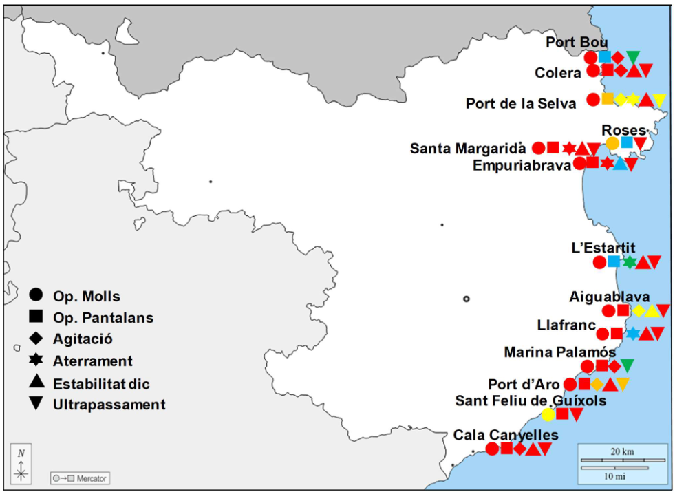
Geographic context and climate challenges The promenades on the Catalan coast with the greatest risk of scouring or overtopping are in the Maresme and in some sections of the Garraf, the Tarragonès and the Baix Ebre stretches. Also, the ports of the northern half of the coast are more exposed to the loss of operability […]
Coastal Management Plan for Boka-Kotorska Bay, Montenegro
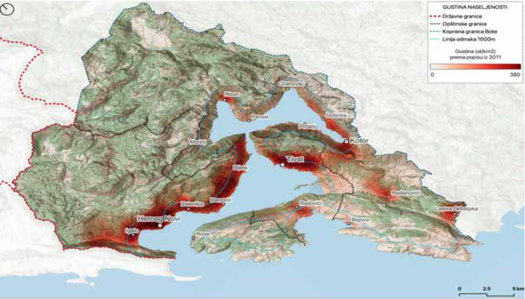
Geographic context and climate challenges The Boka-Kotorska Bay is a unique part of the Adriatic Sea with its specific geomorphological, climatological, hydrological and biotic characteristics. The bay is extremely closed, surrounded by mountains Orjen and Lovćen that “fall” into the sea. In the area of Boka, there are numerous underwater sources such as Škurda, Široka […]
Coastal Zone Management Plan for the City of Kaštela (Coastal Plan)
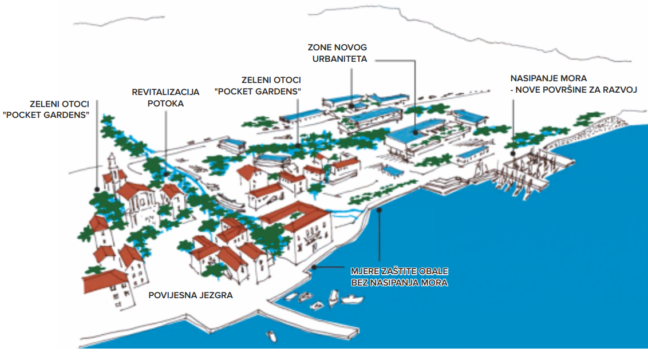
Geographical context and climate challenges The coastal plan covers the administrative area of the Town of Kaštela. The mainland makes up 58 km2, and the coastal part is sheltered by the Kaštela Bay. The length of the coastline is 23 km and almost all of the coast has become increasingly urban. The historical development of […]
Coastal protection and managed retreat of the coastal road between Sète and Marseillan, France
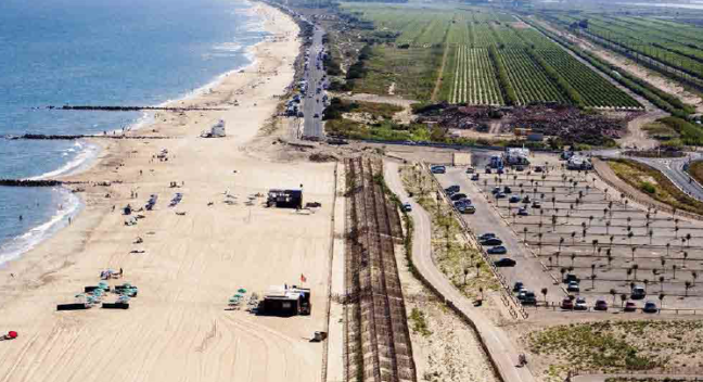
Geographic context and climate challenges The littoral between Sète and Marseillan in the Occitanie region of South France is a sand strip that separates the Thau lagoon from the Mediterranean Sea. The strip is 12 km long and 2 km wide and the littoral hosts different human activities, including a bottle-filling firm, a camping, a […]