Measures to adapt ports and promenades to climate change, Catalonia, Spain
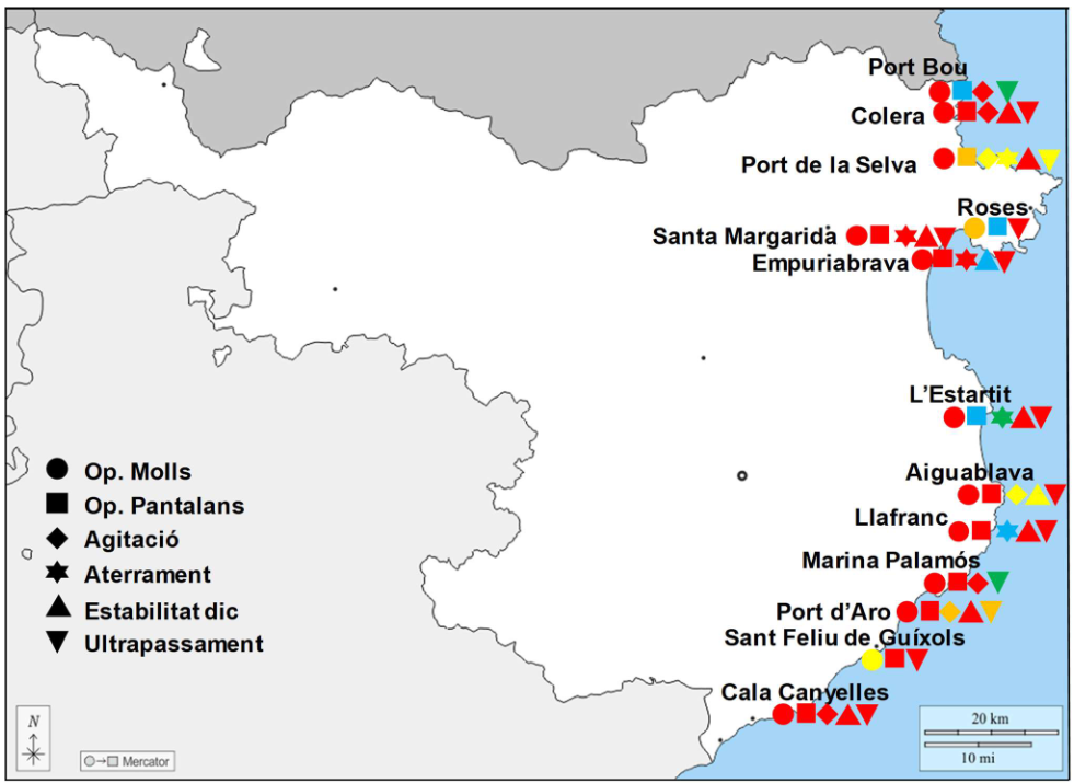
Geographic context and climate challenges The promenades on the Catalan coast with the greatest risk of scouring or overtopping are in the Maresme and in some sections of the Garraf, the Tarragonès and the Baix Ebre stretches. Also, the ports of the northern half of the coast are more exposed to the loss of operability […]
Coastal wetlands of Maristanis, Sardinia, Italy – two transformative projects COAST and SMART GATE.
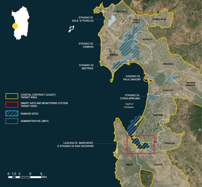
Geographic context and climate challenges The Maristanis project was born with the aim of restoring, protecting and connecting the wetlands of the Oristano Gulf in an integrated system of governance and sustainable development. With their 7,700 hectares, the wetlands stretching from Capu Mannu to the Marceddì lagoon constitute an ecosystem of priceless value recognized by […]
Coastal Management Plan for Boka-Kotorska Bay, Montenegro
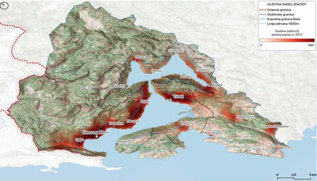
Geographic context and climate challenges The Boka-Kotorska Bay is a unique part of the Adriatic Sea with its specific geomorphological, climatological, hydrological and biotic characteristics. The bay is extremely closed, surrounded by mountains Orjen and Lovćen that “fall” into the sea. In the area of Boka, there are numerous underwater sources such as Škurda, Široka […]
Kune-Vain Lagoon, Albania
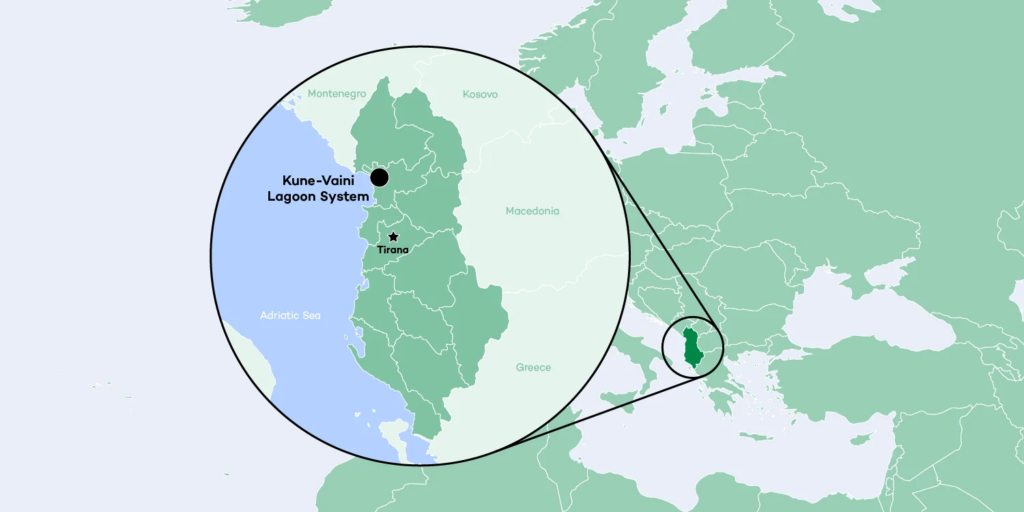
Geographic context and climate challenges Albania is situated in southeastern Europe with a population of 2.85 million. The country has one of the largest and richest wetland systems – mainly in the form of coastal lagoons – in the Mediterranean region. Albania as a nation is suffering from the effects of extreme weather events such […]
Enhancing Climate Change Adaptation in North Coast and Nile Delta in Egypt

Geographic context and climate challenges This project aims to reduce the risks of coastal flooding in the North Coast and the Nile River Delta region of Egypt, especially in the five most vulnerable and endangered hotspots within the Nile Delta with a length of 69 km, which were identified during the engineering scoping study and […]
Coastal Plan Tangier-Tetouan-Al Hoceima (TTA) region, Morocco

Geographic context and climate challenges With some 447 km of coastline stretching along the Atlantic, the Strait of Gibraltar and the Mediterranean coast, the coastline of the Tangier-Tetouan-Al Hoceima (TTA) region boasts a unique geographical position, geomorphological structure and biological diversity (Agharroud et al., 2023). Overall, the TTA region benefits from a Mediterranean-type climate with […]
Restoration of the dune belt in the south of the Bevano river mouth (Lido di Classe, Ravenna, Italy)
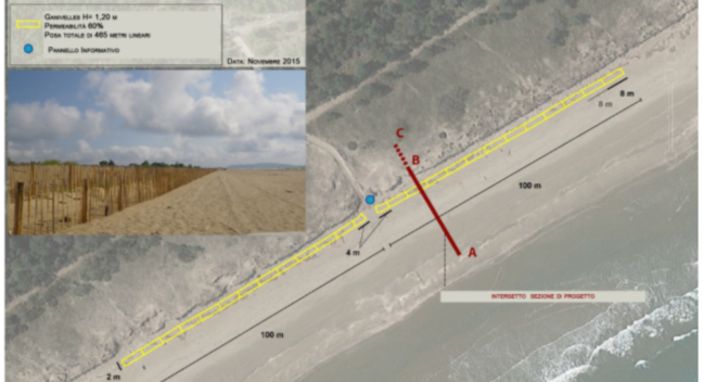
Geographical context and climate challenges The site is located in the south of the Bevano river mouth, between an integral protected area, where access by unauthorized persons is forbidden all year round, and an intermediate protection zone, forbidden for access from April to July during the nesting period of the Kentish Plover (Charadrius alexandrinus). The […]
Integrated system for the protection of Venice and its lagoon against flooding
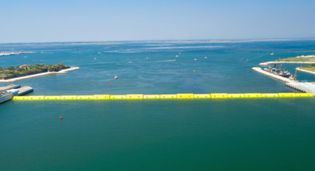
Geographic context and climate challenges Located along the northernmost stretch of the Italian Adriatic coast, the Venice lagoon is a large (550 km2) shallow water (average depth around 1 m) system connected with the sea through three inlets (from north to south Lido, Malamocco and Chioggia). Two main urban areas are located within the lagoon: […]
Coastal Plan for the Šibenik-Knin County, a path towards resilience and sustainability
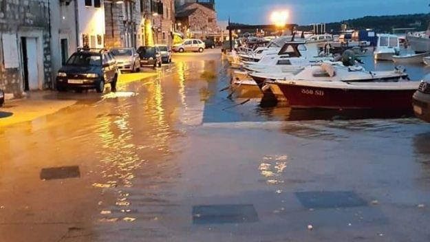
Geographic context and climate challenges The Šibenik-Knin County of Croatia has an exceptionally indented coast, 960 km long, with 285 islands, islets and rocks. The County is rich in natural resources and biodiversity, with two national parks, Krka estuary and Kornati archipelago. Its coastal zone consists of seven municipalities and three cities including Šibenik, […]
Managed retreat of the coastal state road Koper-Izola and sustainable requalification of the coast
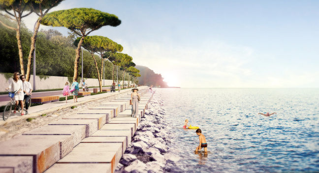
GEOGRAPHIC CONTEXT AND CLIMATE CHALLENGES The Coastal-Karst Region is the only Slovenian littoral region, as well as being a characteristically border region, as it borders with both Croatia and Italy. Koper is the urban regional centre, while also being the main city of the wider Coastal conurbation (along with Izola and Piran). The city is […]