CASAdapt Project: analysing, imagining, coordinating and adapting coastal socio-ecosystems to climate change, Communauté d’Agglomération de Sophia Antipolis (CASA), Région SUD PACA, France
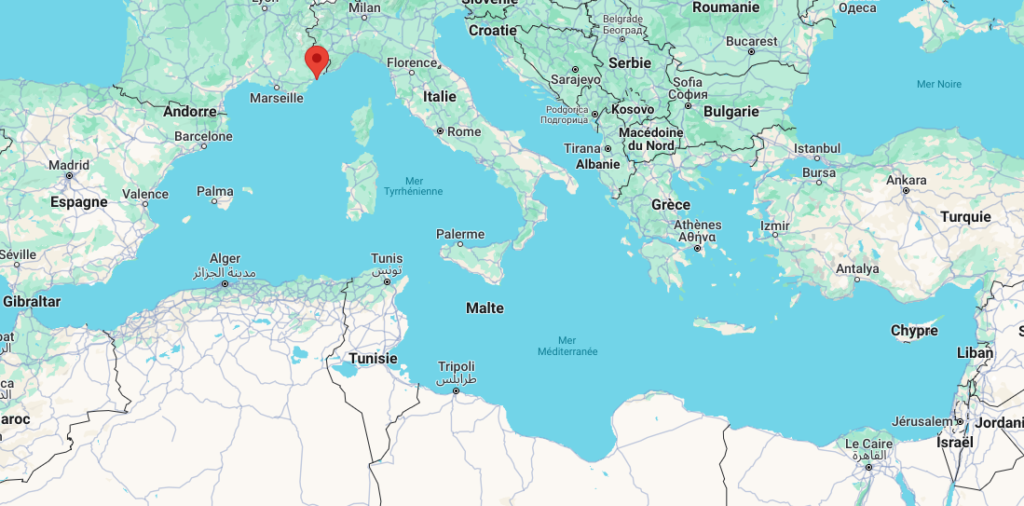
Geographic context and climate challenges The Mediterranean basin, particularly the Provence-Alpes-Côte d’Azur (PACA) region, is highly vulnerable to climate change. Since 1960, the Alpes-Maritimes area has experienced a temperature increase of 1.6°C. Extreme weather events such as heat waves are becoming longer, more intense, and more frequent. The likelihood of centennial floods has doubled and […]
Coastal wetlands of Maristanis, Sardinia, Italy – two transformative projects COAST and SMART GATE.
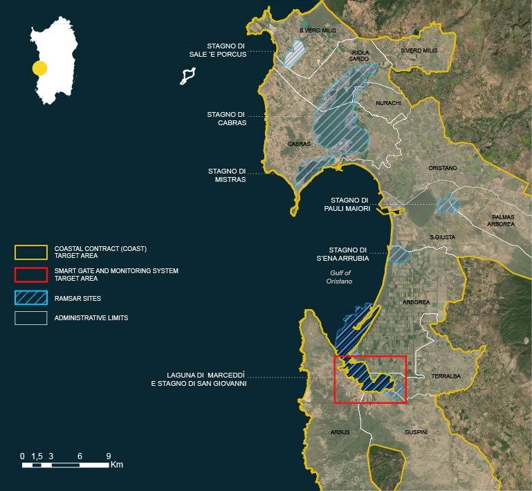
Geographic context and climate challenges The Maristanis project was born with the aim of restoring, protecting and connecting the wetlands of the Oristano Gulf in an integrated system of governance and sustainable development. With their 7,700 hectares, the wetlands stretching from Capu Mannu to the Marceddì lagoon constitute an ecosystem of priceless value recognized by […]
Coastal Plan of Split-Dalmatia County, Croatia
Geographic context and climate challenges Split-Dalmatia County (Županija in Croatian, SDZ) is the largest Croatian county with a total area of 14,106.40 km². Of this total area, a surface of 4,523.64 km² (8% of the Republic of Croatia) is covered by land, and the sea covers a surface area of 9,576.40 km² (30,8% of the […]
Coastal Management Plan for Boka-Kotorska Bay, Montenegro
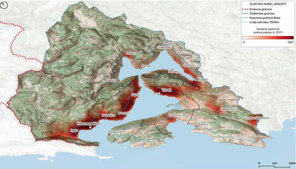
Geographic context and climate challenges The Boka-Kotorska Bay is a unique part of the Adriatic Sea with its specific geomorphological, climatological, hydrological and biotic characteristics. The bay is extremely closed, surrounded by mountains Orjen and Lovćen that “fall” into the sea. In the area of Boka, there are numerous underwater sources such as Škurda, Široka […]
Kune-Vain Lagoon, Albania
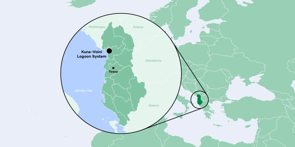
Geographic context and climate challenges Albania is situated in southeastern Europe with a population of 2.85 million. The country has one of the largest and richest wetland systems – mainly in the form of coastal lagoons – in the Mediterranean region. Albania as a nation is suffering from the effects of extreme weather events such […]
Enhancing Climate Change Adaptation in North Coast and Nile Delta in Egypt

Geographic context and climate challenges This project aims to reduce the risks of coastal flooding in the North Coast and the Nile River Delta region of Egypt, especially in the five most vulnerable and endangered hotspots within the Nile Delta with a length of 69 km, which were identified during the engineering scoping study and […]
Coastal Plan Tangier-Tetouan-Al Hoceima (TTA) region, Morocco

Geographic context and climate challenges With some 447 km of coastline stretching along the Atlantic, the Strait of Gibraltar and the Mediterranean coast, the coastline of the Tangier-Tetouan-Al Hoceima (TTA) region boasts a unique geographical position, geomorphological structure and biological diversity (Agharroud et al., 2023). Overall, the TTA region benefits from a Mediterranean-type climate with […]
Coastal Plan for the Šibenik-Knin County, a path towards resilience and sustainability
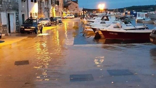
Geographic context and climate challenges The Šibenik-Knin County of Croatia has an exceptionally indented coast, 960 km long, with 285 islands, islets and rocks. The County is rich in natural resources and biodiversity, with two national parks, Krka estuary and Kornati archipelago. Its coastal zone consists of seven municipalities and three cities including Šibenik, […]
Managed retreat of the coastal state road Koper-Izola and sustainable requalification of the coast
GEOGRAPHIC CONTEXT AND CLIMATE CHALLENGES The Coastal-Karst Region is the only Slovenian littoral region, as well as being a characteristically border region, as it borders with both Croatia and Italy. Koper is the urban regional centre, while also being the main city of the wider Coastal conurbation (along with Izola and Piran). The city is […]
Coastal Zone Management Plan for the City of Kaštela (Coastal Plan)
Geographical context and climate challenges The coastal plan covers the administrative area of the Town of Kaštela. The mainland makes up 58 km2, and the coastal part is sheltered by the Kaštela Bay. The length of the coastline is 23 km and almost all of the coast has become increasingly urban. The historical development of […]